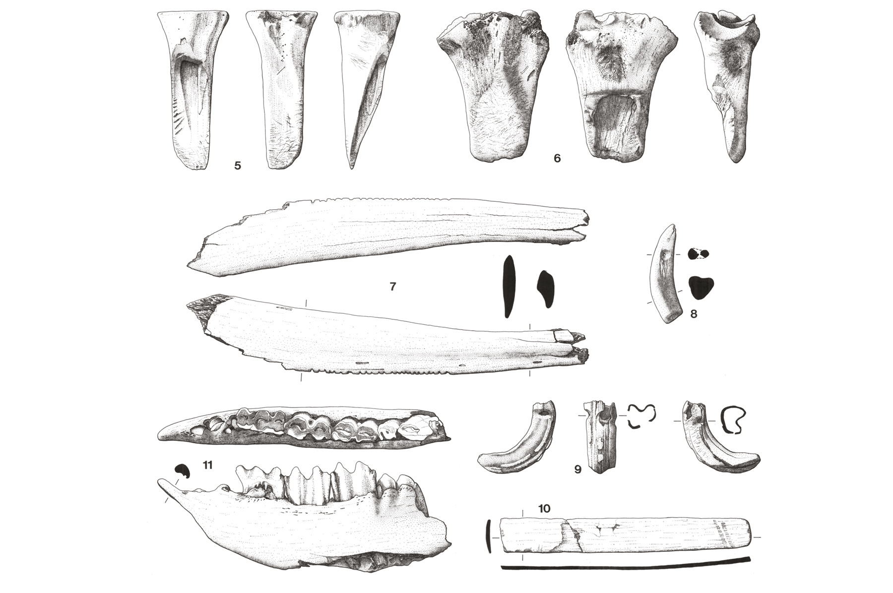
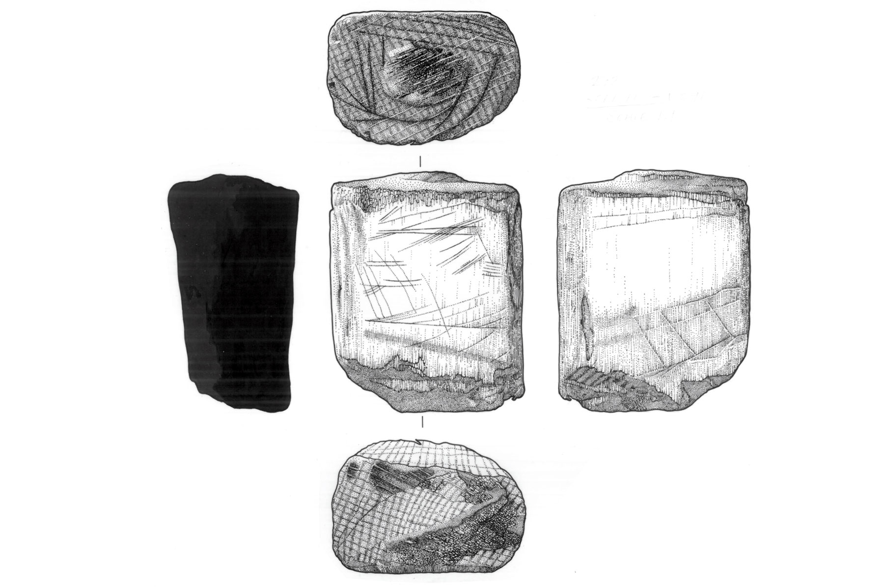
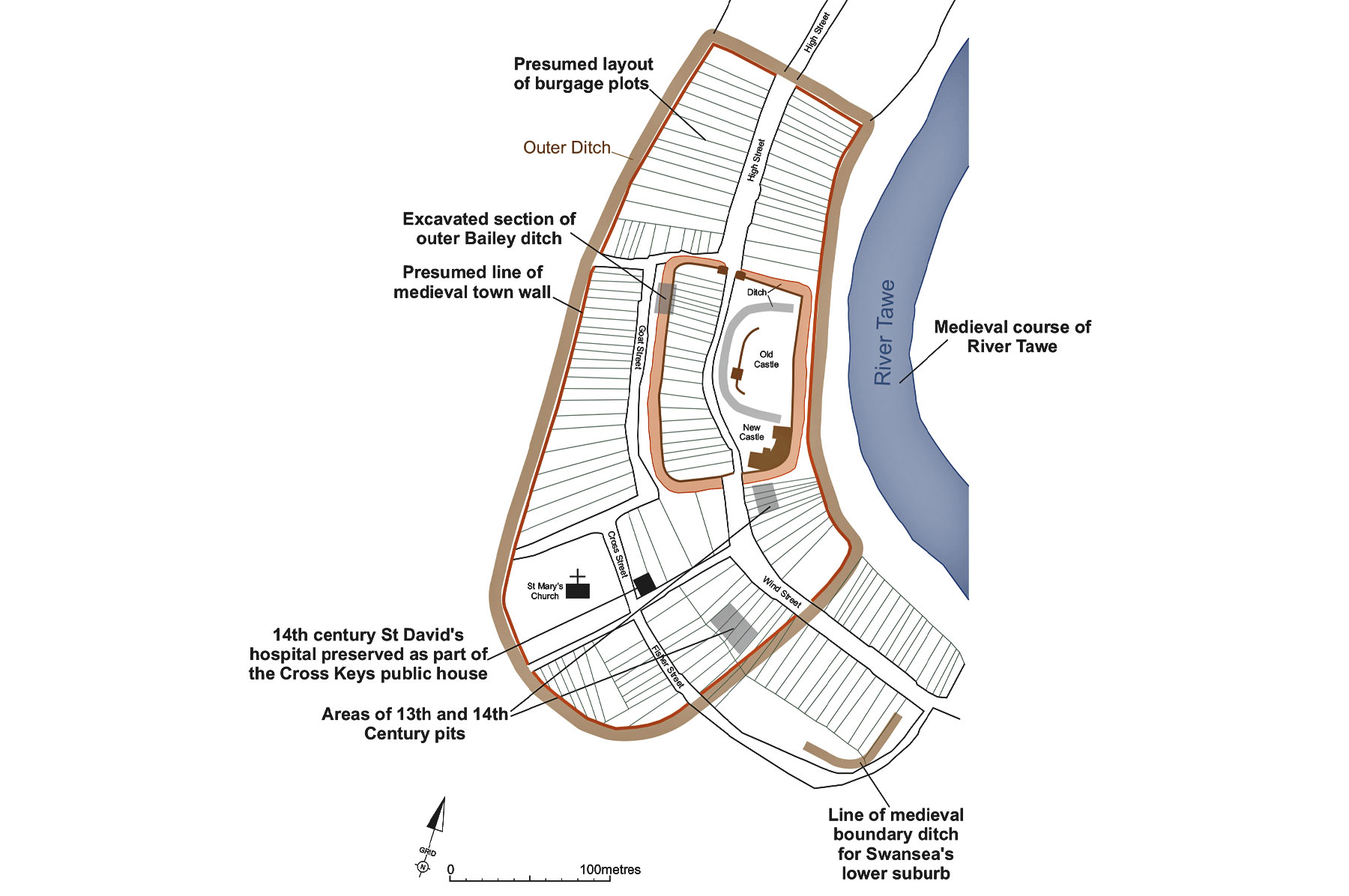
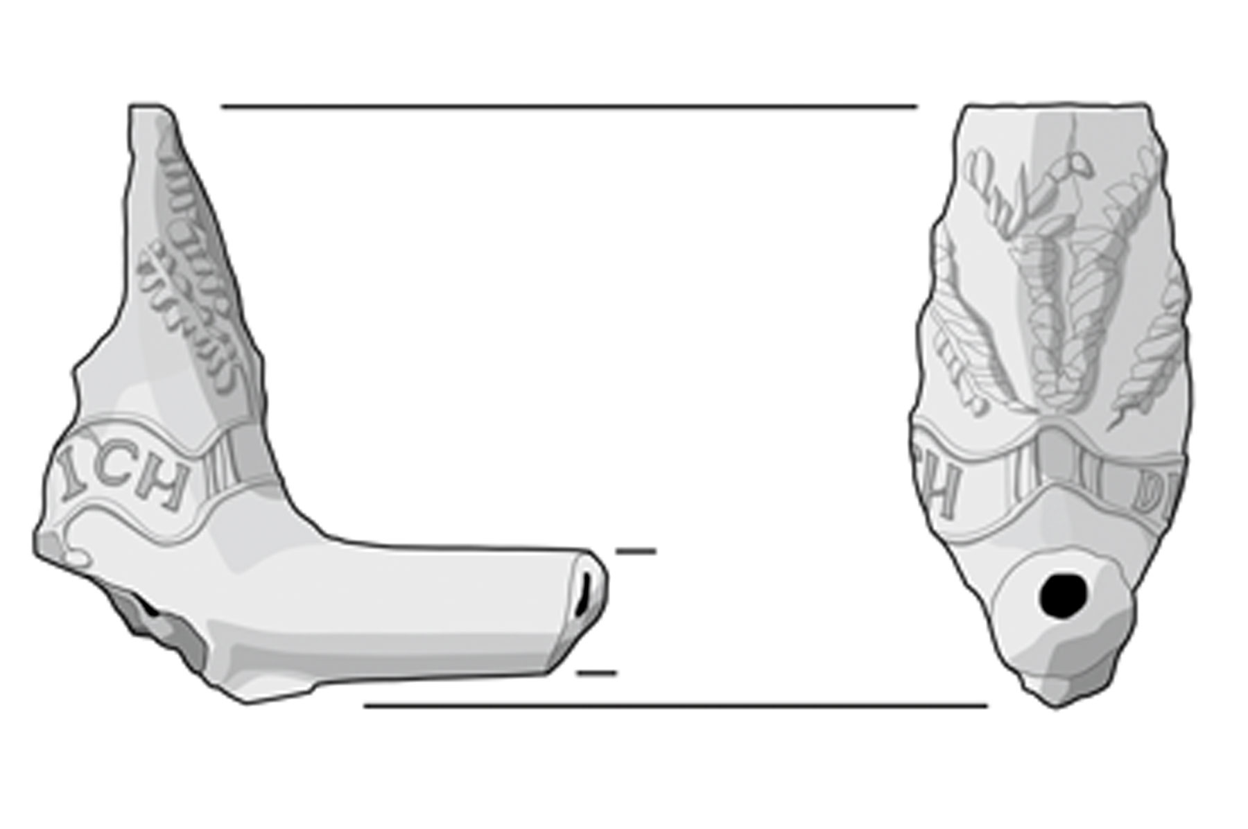
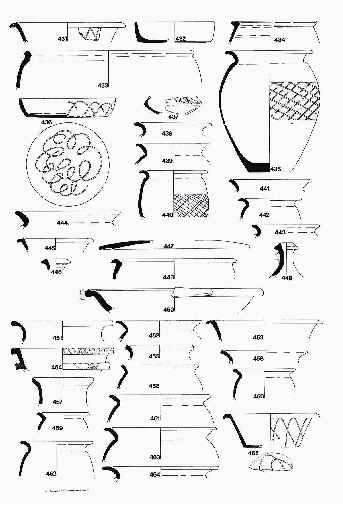
Illustration
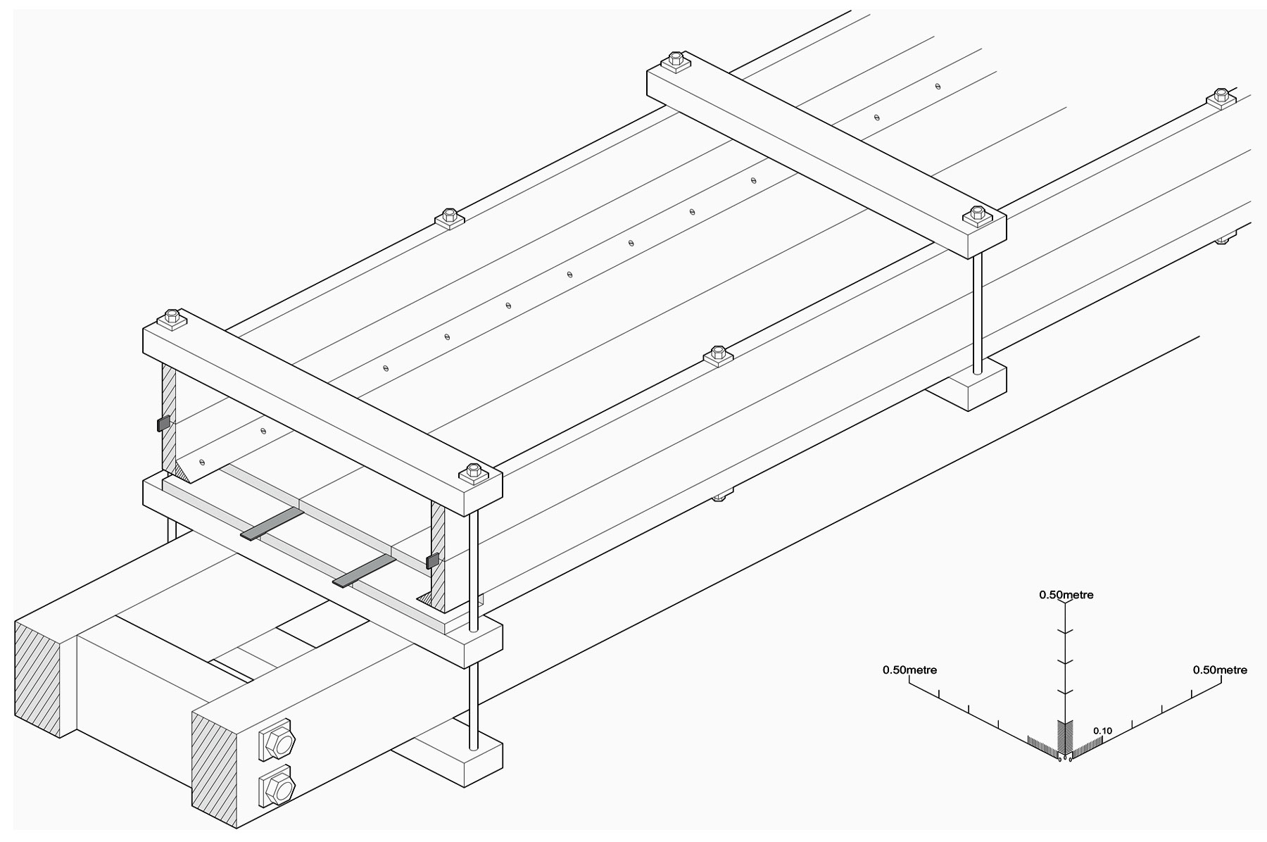
The Illustration department is an integral part of Archaeological Services output, our current staff have over 25 years experience in the production of publication standard illustrations for academic monographs and journals, from measured artefact drawings, technical and isometric diagrams, to site plans, maps, and cross-sections. Our experience and understanding of the wider archaeological audience enables us to provide both creative and accessible graphics for all our clients' needs.
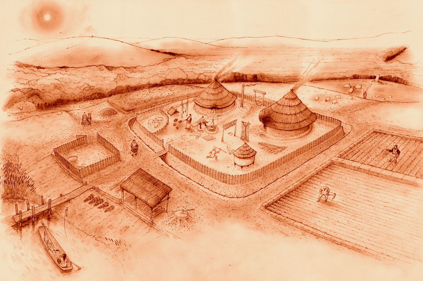
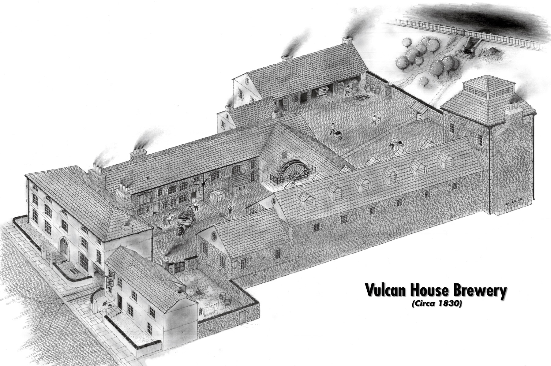
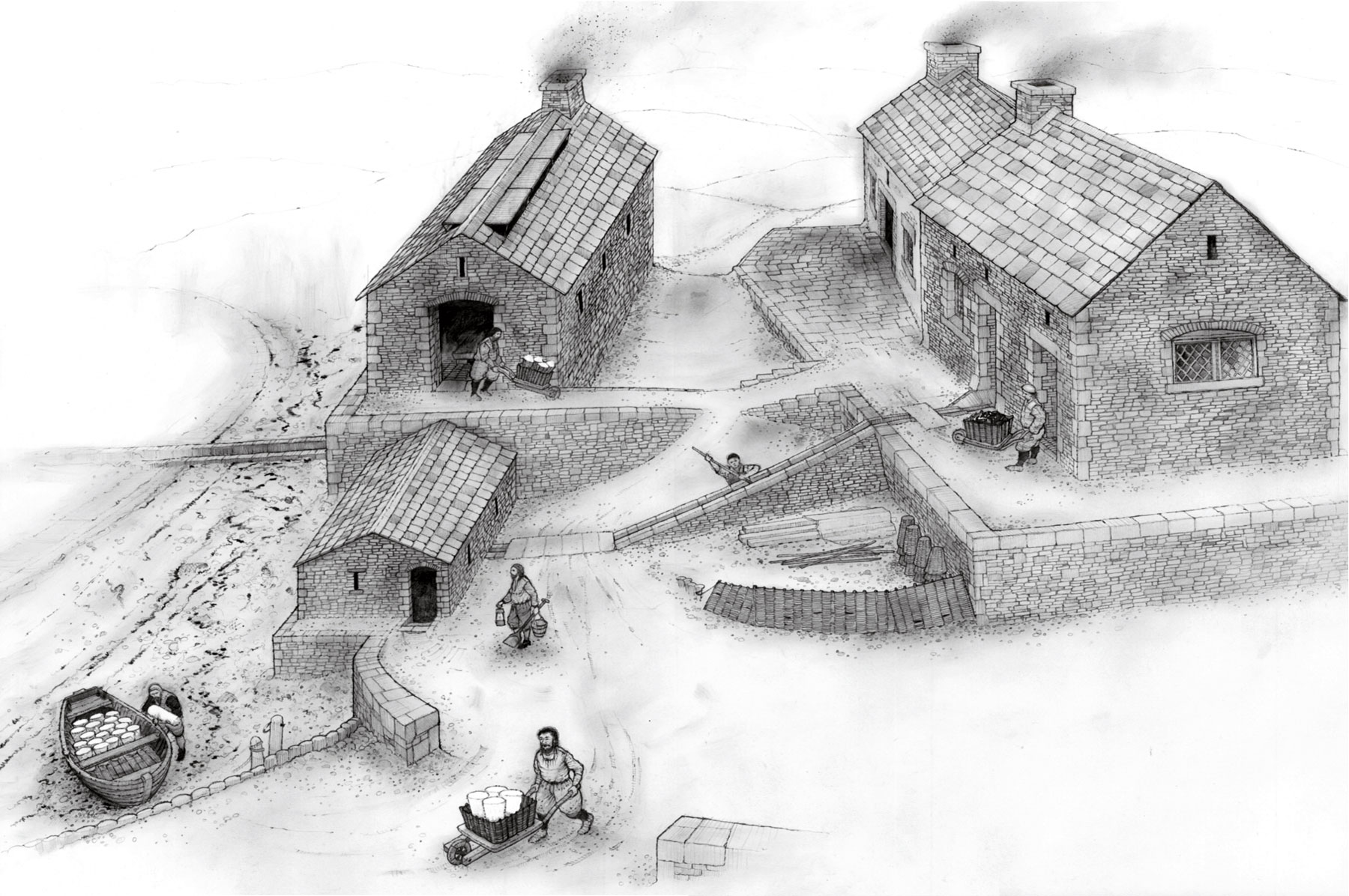
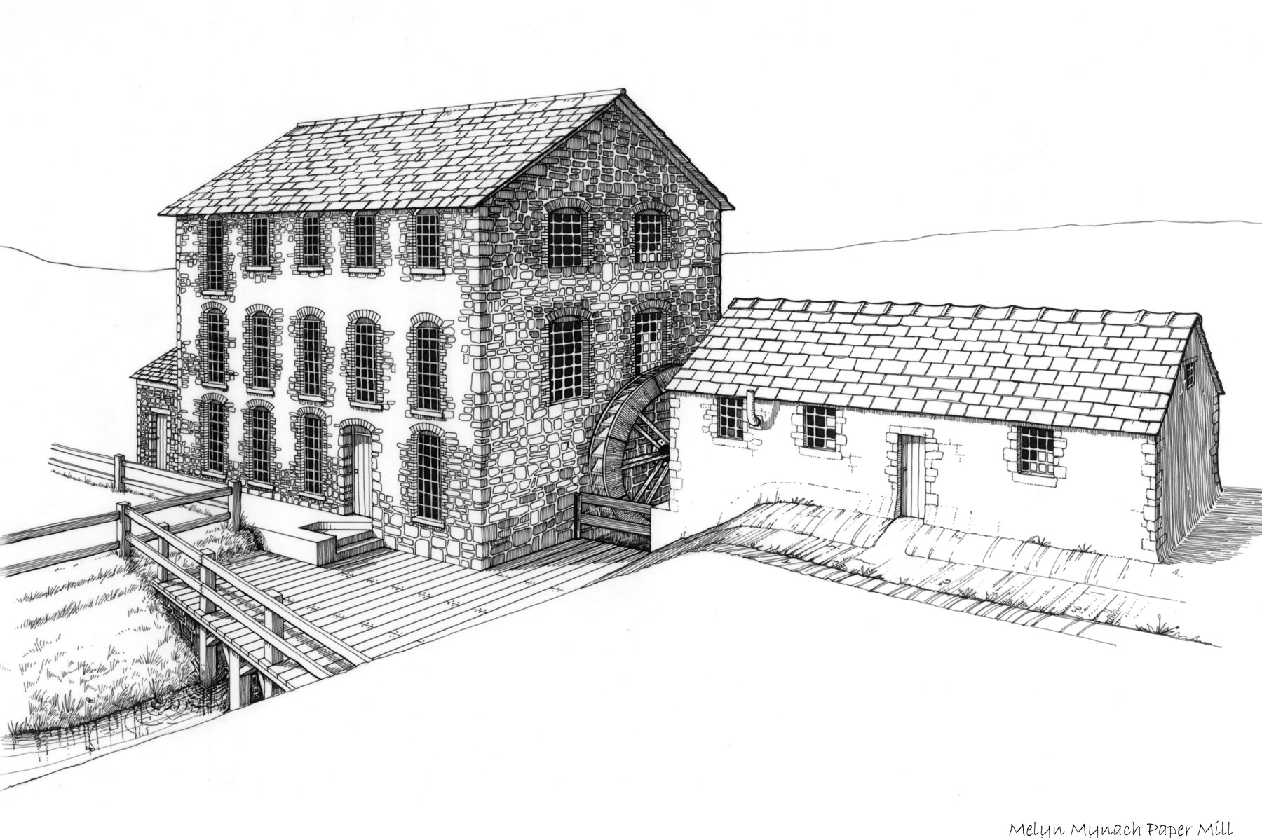
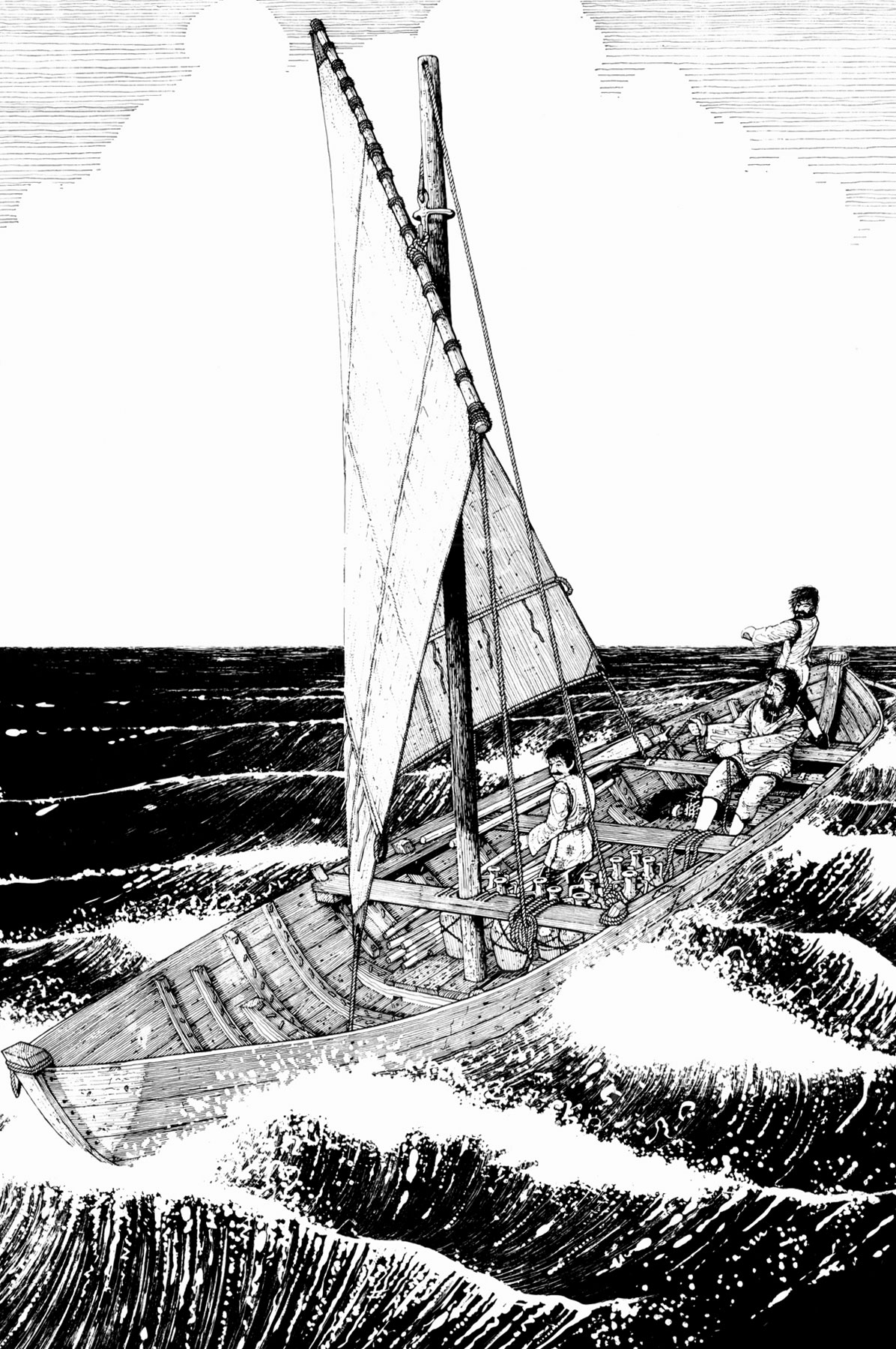
Our illustrators are specialists in pictorial reconstructions, turning the raw data collected from archaeological fieldwork into meaningful images that brings to life the people, objects, places and landscapes of the past.
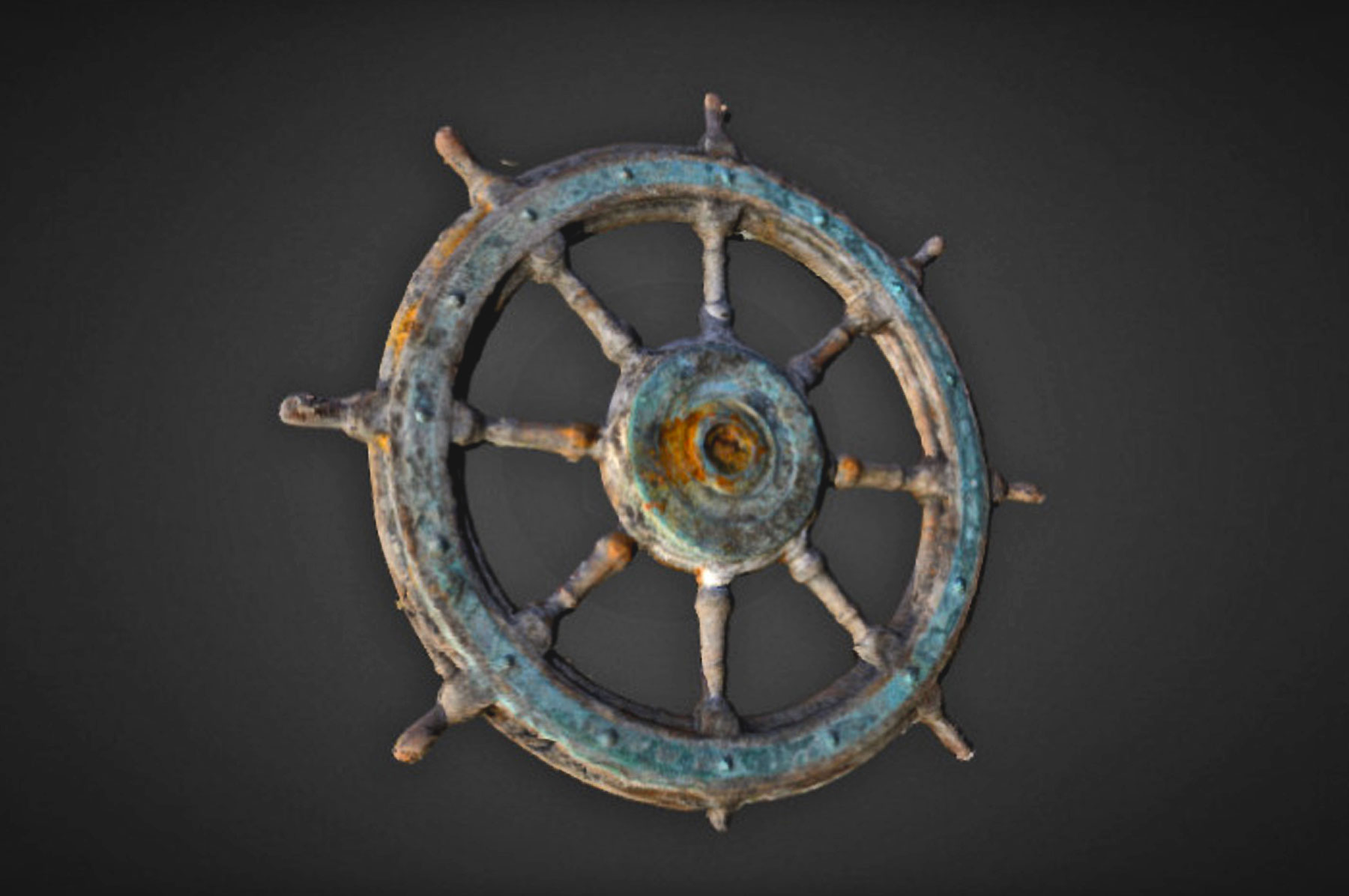
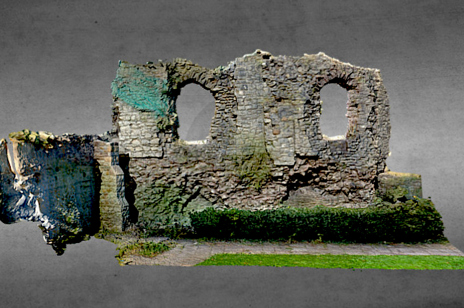
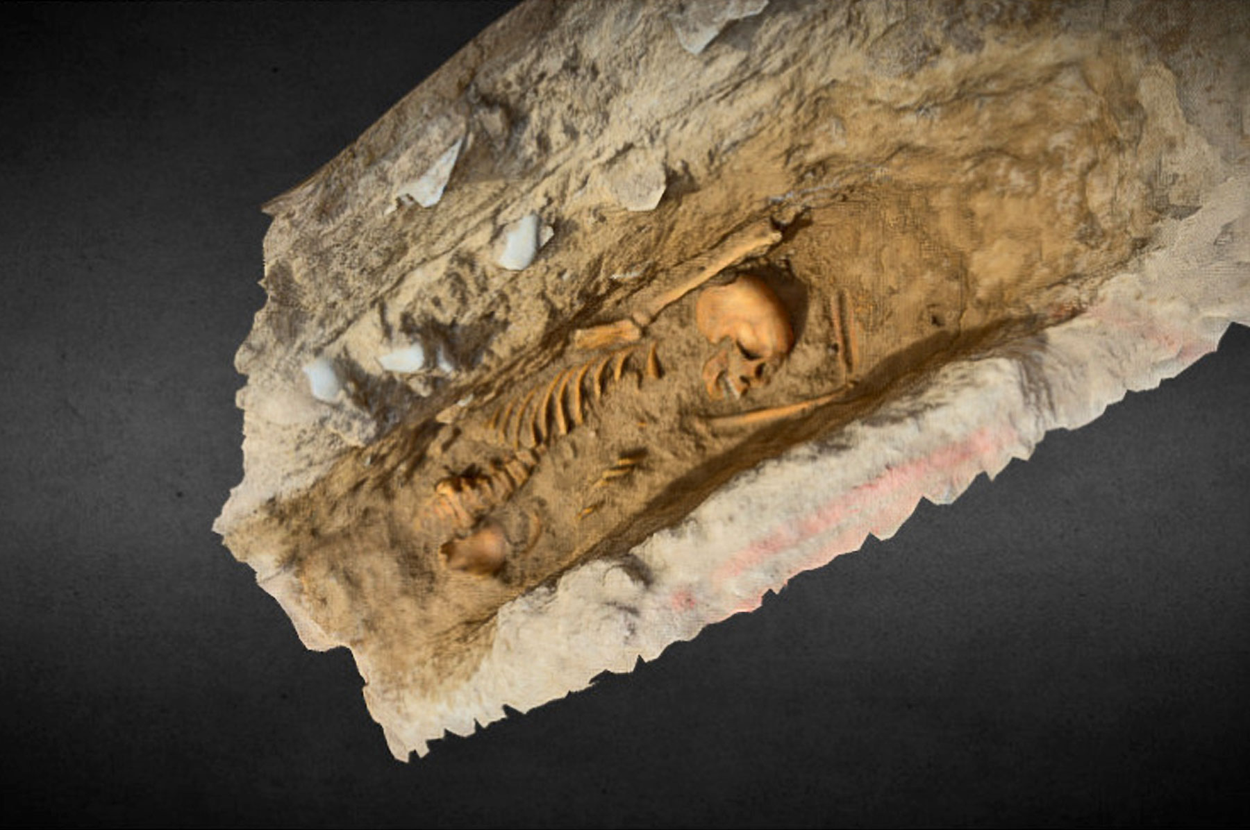
Photogrammetry
Photogrammetry creates accurate fully textured 3D models from photographs and can be used to capture a range of subjects from the smallest objects to entire landscapes. From this data we can create 3D prints, videos and orthoimages (scaled images with no distortion or perspective), which allow for more accurate and complete interpretative site drawings than ever before.
The speed and accuracy of photogrammetry mean that it is now used for many purposes including recording buildings, collapsed structures, graves, complex archaeological features, artefacts and even wghole landscapes. This data quality gives archaeologists a far better understanding of sites and artefacts, and offers a more comprehensive record.
The data collected can be used to share information with specialists around the world, allowing them to view objects, features and buildings remotely, for public display or to produce more accurate drawn records. These drawn records can be incorporated into designs and specifications, publications or site archives.
Examples of our work